
Agences Territoriales (ATE)
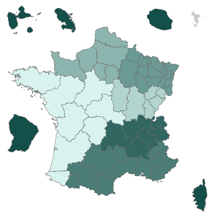
L'ONF est organisé sur la base d'un maillage territorial, fondé sur la répartition géographique de la forêt publique et l'organisation territoriale de l'État. L'organisation territoriale de l'ONF est structurée en deux grands niveaux hiérarchiques : un niveau de pilotage et de soutien et un niveau de gestion et de production. Les Agences et les Directions Régionales sont chargées de la mise en œuvre des missions de l'ONF sur le terrain. Les Agences sont territoriales ou spécialisées. L'ONF est composé de 51 Agences territoriales dont 50 dans l'hexagone et une à Mayotte.
|
|
Proposition de citation
. Agences Territoriales (ATE). http://metadata.carmencarto.fr/geonetwork/105/api/records/fr-662043116-21FB1604-1C35-4A61-9288-72BC5A09E37A |
Simple
- Date ( Création )
- 2018-06-25
- Identificateur
- http://metadata.carmencarto.fr/geosource/105/metadata/fr-662043116-21FB1604-1C35-4A61-9288-72BC5A09E37A
- Forme de la présentation
- Carte numérique
- But
- Périmètre d’une ou plusieurs Agence(s) Territoriale(s). L'Agence Territoriale est composée d'un regroupement d'Unités Territoriales (UT).
- Reconnaissance
- 9200
Propriétaire
Office National des Forêts
-
Groupe de production SIG national
2 Avenue de Saint-Mandé
PARIS Cedex 12
75570
- Fréquence de mise à jour
- Bi-annuelle
- Domaine de la mise à jour
- Jeu de données
- Jeu de données
- \\SSIG052\K\Commun\endo\x9200\geodata\1_org_onf\shape\agg_fr.shp
A l’origine de
Office National des Forêts
-
Groupe de production SIG national
2 Avenue de Saint-Mandé
PARIS Cedex 12
75570
- Mots clés ( Thème )
-
- france , onf , agences , territoriales , structures , organisation , données ouvertes
- GEMET - INSPIRE themes, version 1.0 ( Thème )
-
- Unités administratives
- Limitation d'utilisation
- Licence Ouverte / Open Licence Version 2.0 https://www.etalab.gouv.fr/licence-ouverte-open-licence
- Contraintes d'accès
- Licence
- Contraintes d'utilisation
- Licence
- Autres contraintes
- Citer l'origine des données (citation : Agences territoriales, ONF Paris, 2019.)
- Limitation d'utilisation
- Licence Ouverte / Open Licence Version 2.0 https://www.etalab.gouv.fr/wp-content/uploads/2017/04/ETALAB-Licence-Ouverte-v2.0.pdf
- Contraintes d'accès
- Licence
- Contraintes d'utilisation
- Licence
- Type de représentation spatiale
- Vecteur
- Langue
- Français
- Jeu de caractères
- 8859part1
- Catégorie ISO
-
- Planification/Cadastre
- Description de l'environnement de travail
- Microsoft Windows Server 2003 Version 5.2 (Build 3790) Service Pack 2; ESRI ArcGIS 10.0.5.4400
- Description
- France métropolitaine
N
S
E
W
))
- Exclusion
- true
- Identifiant géographique
-
FRA
- Date ( Publication )
- 1974-01-01
- Description
- Guadeloupe
N
S
E
W
))
- Exclusion
- true
- Identifiant géographique
-
GLP
- Date ( Publication )
- 1974-01-01
- Description
- Guyane
N
S
E
W
))
- Exclusion
- true
- Identifiant géographique
-
GUF
- Date ( Publication )
- 1974-01-01
- Description
- Martinique
N
S
E
W
))
- Exclusion
- true
- Identifiant géographique
-
MTQ
- Date ( Publication )
- 1974-01-01
- Description
- Mayotte
N
S
E
W
))
- Exclusion
- true
- Identifiant géographique
-
MYT
- Date ( Publication )
- 1974-01-01
- Description
- Réunion
N
S
E
W
))
- Exclusion
- true
- Identifiant géographique
-
REU
- Date ( Publication )
- 1974-01-01
- Nom du système de référence
- EPSG / RGF93_Lambert_93 (EPSG:2154) / 7.4.1
- Nom du système de référence
- EPSG / WGS_1984_UTM_Zone_20N (EPSG:32620) / 7.4.1
- Nom du système de référence
- EPSG / RGFG95_UTM_zone_22N (EPSG:2972) / 7.4.1
- Nom du système de référence
- EPSG / RGM04_UTM_zone_38S (EPSG:4471) / 7.4.1
- Nom du système de référence
- EPSG / RGR92_UTM_zone_40S (EPSG:2975) / 7.4.1
- Niveau topologie
- Géométrie seulement
- Type de géométries des objets
- Composite
- Nombre d'objets géométriques
- 50
- Format (encodage)
-
- Fichier de formes (1.0 )
- Ressource en ligne
- Carte de consultation publique des données de l'ONF en Métropole
- Ressource en ligne
-
ATE_FR
Agences territoriales (Flux WFS)
- Niveau
- Jeu de données
Résultat de conformité
- Date ( Publication )
- 2013-12-10
- Explication
- cf. la spécification citée
- Degré de conformité
- false
- Généralités sur la provenance
- Couche obtenue par fusion des Unités Territoriales appartenant à une même Agence Territoriale
gmd:MD_Metadata
- Identifiant de la fiche
- fr-662043116-21FB1604-1C35-4A61-9288-72BC5A09E37A XML
- Langue
- Français
- Jeu de caractères
- Utf8
- Type de ressource
- Jeu de données
- Nom du niveau de hiérarchie
- dataset
- Date des métadonnées
- 2019-11-12T12:53:25
- Nom du standard de métadonnées
- INSPIRE Metadata Implementing Rules: Technical Guidelines based on EN ISO 19115 and EN ISO 19119
- Version du standard de métadonnées
- V. 1.2
Propriétaire
Office National des Forêts
-
Office National des Forêts
2 Avenue de Saint-Mandé
PARIS Cedex 12
75570
- Désignation de la donnée (URI)
- {fr-662043116-21FB1604-1C35-4A61-9288-72BC5A09E37A}
Aperçus

thumbnail
large_thumbnail
Fourni par

Mode d'affichage
fr-662043116-21FB1604-1C35-4A61-9288-72BC5A09E37A
Lien vers le portal
Read here the full details and access to the data.
Ressources associées
Not available